Germany was, as most readers will know, at one time split in two halves by the Iron Curtain.
At some points along the “Inner-German Border” there are still some watchtowers, preserved to show the World what the border looked like. But in many parts the border has just disappeared and is part of the landscape.
To make sure that people do not forget just where that border was, many of the roads that cross that point in Germany have had signs erected, commemorating the fact that Germany was divided at those points.
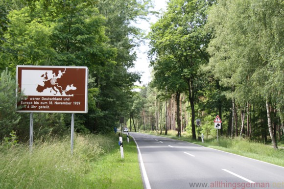
This one can be seen between Brome (West) and Mellin (East). It is also about 25km from Salzwedel, the town in Germany that apparently is the furthest from any motorway exit and happens to be on one of the routes that I use each year to travel to the island of Rügen.
Another can be seen on the A20 motorway which follows the coast of the Baltic sea running eastwards from Hamburg.
The border itself was around 1,400km (860 miles) long.